Tuesday, October 15, 2019

Grit and Glitz

Our second day at the Grand Canyon only afforded us a few hours to explore, and the Bright Angel Trail was the perfect choice. This is one of the routes that people take when they are going all the way down, but many people turn around at an earlier, more accessible point. While I would have like to descend farther than our half-day trips allowed, this timeline made us visit more different points along the canyon. The view was, again, beautiful. While my photos don’t do it justice, they do a better job than my descriptions.


One unexpected bonus was a family of long horn sheep grazing at the side of the trail. We saw them nudging each other with their horns and watched as the baby of the group, complete with fuzzy horn nubs, showed its age by its unsteadiness on its feet as it dislodged a shower of little rocks. We were grateful to encounter them as we descended, as they promptly blocked the trail behind us and delayed the hikers who were returning to the rim.

See the little baby in the middle?


Our time at the canyon complete, we repacked the car and headed to the stop most prized by the trip’s engineer: the Hoover Dam. This gigantic dam – the largest in the country – holds back the flow of the Colorado River, allowing water management strategies that steadied the water supply to the region, allowed the growth of Los Angeles, and supported 80% of the winter produce grown in the United States. As if that weren’t enough, it’s also a huge source of hydroelectric power, as evidenced by the tangles of power lines running up both sides to Arizona and Nevada. Josh was in awe, and I will admit I was pretty impressed.


Our tour of national parks and engineering marvels complete, we ventured to a different kind of national landmark – Las Vegas. In addition to being completely overwhelming after a week spent in the woods, Las Vegas is impressive in its ambition. The hotels are larger than you ever dreamed they would be. They offer every convenience, working to ensure people never need to leave their doors. Restaurants, alcohol, and slot machines at every turn? Child’s play. How about tattoo parlors, IV hydration centers (for your hangover – or as a precaution!), oxygen bars, fine art galleries, and 100-oz alcohol cups that dangle from a lanyard? Walking the strip at night is like walking through an endless Times Square, with buildings clad in screens advertising six different Cirque du Soleil shows (including an 18+ only version), shows by seemingly every winner of America’s Got Talent, and rock and pop acts from the '70s through today. Locals full of hustle shove paper advertisements or free entry coupons into your hand as you pass, and girls dressed in whatever skimpy combination of fishnets, feathers, and rhinestones they could find offer pictures for a price. Restaurants compete with attractions as much as with food, from a humongous beach chair out front for that perfect photo to the world’s largest Pac Man game (seizure warning clearly stated). It is a city ready to please, ready to fulfill your every whim or desire with exemplary convenience.

Josh and I checked in after a marathon walk through rows of slot machines, gambling video games, and poker tables. Hotel rooms are relatively cheap in Vegas, as they make their money other ways once you get there. We meandered down the strip on our way to our main event: dinner. Since we don’t gamble, didn’t find any shows that piqued our interest, and had been surviving on PB&Js and Costco bulk snacks for most of our meals, we decided to indulge in a really nice dinner. After three hours at Joel Robuchon’s namesake restaurant, I can confirm that it was totally worth it. I have learned that any restaurant with a dedicated bread guy is going to rank well on my list, and this restaurant had a bread guy and a butter guy. Every dish was just right – unexpected pairings that added richness or crunch or contrast in all the right places. Plus, Josh and I learned that when you want to have multiple dessert courses, you just call the first one a “palate cleanser” and nobody looks at you funny.

On our way home, we strolled past the Bellagio to enjoy the water show – a sweet and simple way to end the evening.


Spotted: Over the top hotel décor, courtesy of the Bellagio.
Chihuly glass on the ceiling of the Bellagio lobby

A strange exhibition with mechanical animals covered in flowers, stones, chickpeas, and quinoa (among other things) in the Bellagio.


You're a Grand Old Park

We left Utah in our rearview mirror today and headed on to the last national park of our trip: the Grand Canyon. About halfway between Zion and the Canyon, though, we made one pitstop at Horseshoe Bend. 
This odd and beautiful bend in the canyon etched by the Colorado River represents a 270-degree turn in the course of the river, leaving a rocky promontory in the center. A mile-long hike from the parking lot (adorned with National Park System insignia but sadly not covered by our America the Beautiful pass) winds down through the desert sand to and overlook. Far below, we could see evidence of kayaks, tents, and other watercraft as people appreciated Horseshoe Bend from a very different vantage point. The river far below looked relatively calm, belying the superpower that has carved out this canyon and defined the landscape.

After our brief introduction to the power of the Colorado River, we saw its masterpiece: the Grand Canyon. At 277 miles long, an average of a mile deep, and up to 18 miles across (rim to rim), the Grand Canyon is humongous. We spotted its rippling crevice in the distance hours before actually arriving at the park, a rent in the earth that we knew could be nothing else. 
It wasn’t until we arrived at the park and were able to creep out to the canyon rim, though, that we could peer down into its depths and appreciate the canyons within canyons. 
While many of the pictures I had seen featured red, red, rocks and a smooth sheer cliff face plummeting to the bottom, the part of the canyon we visited had more layers as it funneled down to the river bed. As we arrived at the canyon in the afternoon, we used our limited time to venture down into the canyon on the Kaibab Trail and then walk the rim. The Kaibab Trail reminded us of the Navajo Loop at Bryce Canyon: steep descent along switchbacks followed by a steep ascent. Since the path all the way to the bottom here is quite long, however, our path was an out-and-back instead of a loop. I had a dream of going rim to rim after my adventurous and sickeningly fit friend Wookie did so on his Wookie Runs America tour, but Josh forced me to accept my mere mortal status and rein in my expectations for our Grand Canyon visit. Once we were on the trail, I saw his point. The park signs had repeatedly emphasized that rim to rim required an overnight in the canyon and that altitude sickness and heat exhaustion were both very real dangers of that hike, but it was seeing the exhausted faces of the hikers completing their ascent with a full backpack of gear that really drove it home. Alas, another time when I am more fully prepared.

Even though we only descended partway, the view was still beautiful as the canyon unfolded before us. The cliffs were so steep in places, so variable in others. Vegetation had long since adjusted and grew in sparse clusters or straight out of the rock wall at sharp angles, vying for sunlight. Repetitive undulations of rock were visible by the North Rim. From trail signs, we learned about more of the differences between the North and South Rims. While the South Rim is supposed to offer better views and better hiking, the North Rim has most of the precious resources, namely water. To transport water from the North Rim to the parched South Rim and its visitors, a 15-mile pipeline has been constructed across the canyon. This water is then pumped up to the rim and stored in large tanks, as malfunctions or leaks of this long pipeline are common. We sipped from our water bottles with greater respect.

The Colorado River winding at the bottom
After hiking back up the Kaibab Trail, we wandered the Rim Trail back towards the Visitor’s Center. While the whole Rim Trail stretches about 12 miles, we walked around four miles of it. Though the outlooks were frequent, we did notice subtle changes in the views as our light and angle changed. The whole view was so vast that it was hard to take it all in at once, anyways. Each view revealed new details, new subtleties in the rock formations.


Hiking complete, we headed to our hotel to check in. While we envisioned this being a swift process, we got waylaid in the parking lot by a fascinating sight: more than a dozen perfectly restored Model Ts lined up next to one another in the lot. We peered at the wooden spokes of the wheels, the actual horns attached to a squeezable bulb, the elaborate lamps that served as headlights, the license plates labeled “Horseless Carriage”, and the spare wheels strapped to the side in special leather cases, looking for all the world like life rings. We talked to some of the owners for nearly an hour, learning that Model Ts are still plentiful across the United States (250,000 currently registered) despite being 100 or more years old. Since tens of millions of these vehicles were made, getting your hands on one only costs a few thousand dollars, and spare parts for repair are apparently not hard to find. As a result of the low barrier to entry, these car fanatics never own just one; most owned at least 4 Model Ts while one owned 26. By the end of the conversation, I knew more about Model Ts than I did about my own car.


Spotted: Elk! First, we spotted them lapping up the drops of water at the bottle refill station, but we also saw them lounging in the shade (check out those horns) and peeking out from behind trees along the path.


We heard this bleating baby elk before we saw it

Sunday, October 13, 2019

Narrow-minded


We awoke in absolute darkness – and out here, that really means absolute darkness – and headed into Zion National Park before the sun rose. We parked in the visitor’s lot and hustled to wait in line for the first shuttle. Today was our day to hike The Narrows, possibly the most famous hike in the entire park, and we wanted to get there early. The Narrows is a relatively shallow river wending its way between two sheer cliff faces no more than 30 feet apart but hundreds of feet tall, creating a 17-mile narrow waterway. Since the majority of this waterway is a few inches to a few feet deep, it is hiked by hundreds of visitors every day. Going from the bottom up, the most accessible way, requires a shuttle ride to the end of the line. At that point, you take the Riverside Trail and can enter the water almost immediately. Since we were trying to get a jump on the crowds, we sat in the front seats of the first bus, were the first to exit, and hurried to the trailhead while other visitors paused to put on gear or take one last bathroom break. We hiked the Riverside Trail on land and used the last river access point to enter the water.

You can hike The Narrows wearing just about anything if you’re determined enough. That said, a little bit of help from specialized gear makes the whole experience far more pleasant. Josh and I had rented full dry suits, neoprene socks, boots, and walking poles.
This combination would keep us dry and sufficiently warm to wade as far up The Narrows as we dared (on the bottom-up route, I don’t think you’re allowed to go more than 5 miles, but most people stop by the 3-mile point). We felt the dry suits were a smart move, since the water would get at least waist-deep for Josh (higher for shrimps like me) and was supposed to be mighty cold. The day before we went to The Narrows, park rangers were announcing to every group waiting for the shuttle that the water was running down from a lake high up the mountain where the temperature was nine degrees overnight, and the water saw no sunlight until it hit The Narrows (and not much even then). Risk of hypothermia was higher than usual. And, as we have heard before, your safety is your responsibility. We zipped ourselves into those dry suits without a second thought and prayed that our feet would go numb quickly. Surprisingly, we saw few other people in full dry suits. The majority had opted for dry pants with a sort of tight-lacing boot system that seemed to be different from ours. A few of the bolder ones hiked without any sort of dry pants or suits, soaking themselves to the waist or chest and trudging onward. We saw a couple in short shorts whose legs were beet red in protest of the frigid water. In our suits, we stayed surprisingly warm, and our feet did, too.

As we hiked through The Narrows, we quickly learned several things. The pole was incredibly helpful and saved us repeatedly from slipping on smooth underwater stones or stumbling in strong current. One side of the river was typically much shallower than the other, and depth of the water made the biggest difference in difficulty moving forward (moreso than current, in my opinion). Therefore, we crisscrossed the river more times than I can count to facilitate forward progress. While we typically stuck to shallower water, the dry suits were really fun and sometimes a deeper pool proved irresistible.
The other thing that was easy to forget at first, as we clumsily hiked through the river, was to look up. In the morning light, the shadows playing on the cliff walls were beautiful.


With the slipping risk, though, it was easy to sometimes look at nothing but our feet. And the final thing? Coming early was worth every bit of preparation and lost sleep. Having the place largely to ourselves was magical, something we didn’t fully appreciate until the hoards of other visitors caught up with us as we trekked back downriver in the afternoon. That kind of tranquility in the morning allowed us to watch a skittish young mule deer who had been drinking from the river scamper nervously back to its parents, all of them turning their large ears and faces towards us once they were reunited. It meant hearing the river’s rhythms underfoot, hearing only our voices echo along the walls.


After hiking about four miles upriver, we paused for an incredibly picturesque lunch and then headed back. We stopped for one side excursion to the Veiled Falls, which are about a mile up a river that joins the main river of The Narrows. While the hike to the Veiled Falls is quite pretty, getting to the actual waterfall requires either a dry suit and some serious shimmying and lifting of oneself over large rocks or squirming through a very small hole between large rocks and pushing past some roots to emerge on the other side. The waterfall was only about 12 feet tall and rather underwhelming, so we would recommend the walk but not the obstacle course required to see the actual, diminutive falls.

As we got farther and farther down the river on our way back, The Narrows exploded into a riot of color, bodies, and noise. There were people everywhere, clad in varying amounts of gear (see above) and chattering. There were visitors contorted into odd yoga poses on top of mid-river boulders, presumably photodocumenting their fears for Instagram. The Narrows no longer had that sort of sacred quiet and shadow. In the bright light of midday, the secretive nature of the place had fled.

While The Narrows had given us a full morning of adventure, it took all of our energy.
Tired, happy adventurers post-Narrows
We flopped on the shuttle bus and were revived only after a hearty lunner at Oscar’s. One of the employees at Zion Guru, where we rented our dry suits, had recommended Oscar’s as the perfect beer and burger place for a casual dinner out. We had one of our best meals of the trip there; everything we ordered was delicious. Highly recommend if you ever find yourself in the area.

Spotted: The dangers of glamping. We figured we had to try the glamping trend, if only because there were limited housing options in the Zion area. While the semipermanent stretched canvas structure, with its large bed, fuzzy pillows, and ridiculous tiny crystal chandelier provided a cozy abode for one night, there was one issue: it was mid-October in Utah. The heater placed in the tent ended up being purely decorative unless you were standing less than 2 feet from it, and it was really the six blankets we piled on the bed that kept us toasty until morning.

Saturday, October 12, 2019

Where Angels Alight

We made it to Zion! Possibly the most talked-up stop on our National Park mini-tour, Zion did not disappoint. The drive in is magnificent, with giant stony monoliths rising to the left and right of the red, winding road. Yep! Even the pavement is red for the first few miles of the drive into the park.


A long tunnel burrows over a mile through one mountain, with little side lookouts cutting through the darkness, teasing the beauty that awaits. A gentle stream winds lazily down the middle, its cold waters nurturing a lush greenery where the mountain bases meet. People became aware of Zion (which was, of course, not yet named Zion) at the start of the 20th century when a painter lived here for a summer, then presented his paintings at the St. Louis World’s Fair. Visitors to the fair couldn’t believe this place, with its steep red cliffs and gorgeous rainbow landscapes, really existed. Over the next few decades, Zion achieved National Monument – and later Park – status as well as its current name, and the rest is history.

Our first stop was The Grotto, takeoff point for the renowned Angel’s Landing.
A look up at Angel's Landing (right)
Each national park offers a little map and another larger newspaper-like printout that describes the trails and ranks them by difficulty. Angel’s Landing falls solidly in the “strenuous” category, which at Zion also includes warnings to avoid these trails in the event of rain, wind, or snow due to precarious footing. The newspaper also had a stern warning that these trails are not for those with a fear of heights. The weather was practically perfect in every way, but Josh has a mighty case of fear of heights. Undaunted, he picked Angel’s Landing as our introduction to Zion. The first part of the hike was a steep two-mile ascent along a smooth, paved trail. Then, you reach the top of that particular hill (a local maximum of sorts) and the real hike begins. Along a thin, winding trail along bare rock face, precarious enough to require chain handholds for the majority of the ascent, hundreds of people of varying abilities stream out to Angel’s Landing and back. This makes the trail not only crowded but filled with clusters of people clinging to rocks, chains, trees, and anything that appears solidly attached to the mountain. Any place that the trail widens to more than a foot or two across becomes a key gathering point, allowing foot traffic heading the opposite direction to pass and free up the chain handholds. Each cluster of climbers peers ahead, trying to spot a break in the oncoming traffic so they can make it to the next wide point. Guess right, and you make some death-defying forward progress. Guess wrong, and you are suddenly battling for the meager foot space with strangers who must reach around you on the chain to relieve the bottleneck. While most of the ascent was fine – at least, once you had the hang of it – there were a couple places where the mountain fell away beneath our feet, a couple where we had to pull ourselves up (or lower ourselves down) entirely on the chain, and several where there was no chain and we had to scramble across an exposed stretch of rock while being buffeted by gusts of wind. I found the whole thing a little thrilling, but Josh was less of a fan. His fear of heights finally reared its head about 90% of the way up and forced him to sit out the last few chains’-worth of ascent. I continued on, quickly reaching the top after scrambling across one last long stretch of bare rock through the wind. To be honest, the view was not all that different from where I had left Josh, but it was unobstructed and certainly beautiful. While I don’t know which poetic adventurer named this place, it’s not hard to imagine the angels approving of this spot.
View from the top of Angel's Landing, to the right
View from the top of Angel's Landing, to the left
To make the most of the day, we also walked the path to the Lower Emerald Pool. The lush greenery around this pocket of water starkly contrasted the dry, dusty path we had taken to Angel’s Landing just hours earlier. Pools such as these allow wildlife to flourish in Zion. On the walk to the pool, we saw mule deer grazing, their enormous ears twisting too and fro and a constantly surprised look on their faces.
Note the butt of a baby mule dear just behind the one in the foreground
We saw not one but two tarantulas, much to Josh’s dismay (although to the excitement of a five-year-old boy who named one “Jeff”).
Everyone, meet Jeff.
We have also been lucky enough to see other wildlife around Zion, including big horn sheep, little lizards, numerous birds, very brave chipmunks, and strange waddling squirrels.
Lush greenery along the Virgin River that winds through the park
A bee on the ubiquitous yellow wildflowers we have seen across Utah
While our first day at Zion has been idyllic, there are constant reminders that this place is still wild and has its dangers. Shuttle stop #7 is closed indefinitely due to three rockslides this year, one of which injured three visitors and all of which have destroyed trails – although the damage has not yet been fully evaluated due to the ongoing danger. Similarly, a sign at the beginning of the ascent to Angel’s Landing announces that nine people have fallen to their deaths since 2004 attempting this climb. We had seen people nonchalantly climb in flip flops, carrying infants in their hands, and posing for photos with uncertain footing. I’ll admit, there was a part of me that was surprised that number wasn’t higher. Of course, everything at Zion mentions keeping the parks in their natural wild state, despite the associated risks. Visitors are constantly reminded that our safety is our responsibility. But my other favorite phrase they use on visitors? “Be like Bigfoot – leave no trace.”

Spotted: Endofthe Road. This road sign, which we encountered on our drive to our much-further-out-of-the-way-than-expected lodge, cracks me up every time we pass it. I have to believe the person who named the street and possibly still lives there is hilarious.

Friday, October 11, 2019

Hoodoo You See?


After several days based in Moab, we ventured further west, following I-70 (again) through Utah. Disconcertingly, flurries began not long into our drive and continued for the next several hours. It was time to face the facts: the temperature was below freezing and would be so for the next couple of days of our trip. We continued on to Bryce Canyon, land of the hoodoos. The term hoodoo refers to “tall, thin spires of rock protruding from the bottom of an arid drainage basin or badland”. Many of them are formed of soft stone with a top crust of harder stone that partially shields the top from erosion, even as the sides wear away. Nowhere are the hoodoos more plentiful than in Bryce Canyon, Utah.

On arriving to Bryce, we headed out on the Navajo Loop-Peekaboo Loop combo trail within the Bryce Amphitheater, which started off with a steep descent from a stunning outlook to the base of the basin.


Manmade switchbacks were the only thing softening the descent down hundreds of feet.

The steep, sheer cliff faces rose up around us on the Navajo Loop, but it was on the Peekaboo Loop that we got to get up close to the hoodoos of various sizes. Those at the top of the cliffs were scraggly, worn nearly to nothing, while beefier hoodoos decorated the lower parts of the basin.

We saw several familiar windows and arches, including one well-marked point of interest called Two Bridges consisting of two rather puny small arches that, well, weren’t very impressive after several days at Arches. They were no Delicate Arch, if you get what I mean (this coming from a newly minted arch-viewing expert). Still, the hoodoos alone are enough reason to visit Bryce. Plus, with the short distance from parking lot to trail and several shorter trail offerings (albeit with a lot of elevation change), the place was crawling with families. It was also the first place we saw some visitors testing the limits of their wheelchair motors as they sped along the rim trail. We also saw several under-four children near the point of exhaustion tantrum on the ascent back up to the parking lot, but everyone seemed to be managing.

After completing the aforementioned loops, we walked the canyon rim to Inspiration Point, an overlook offering unmatched views of the canyon. The sheer number of hoodoos, stretching for miles in fairly neat rows, made the whole area look like a rippling series of stones.


Bryce Canyon also offers a series of viewpoints along the paved stretch down the middle of the plateau. We stopped at two – Natural Bridge and Rainbow Point. Natural Bridge was yet another arch; apparently it was misnamed because bridge refers to a different geologic creation process. It was quite beautiful, although one spindly section at the right edge made us wonder how long it would last (in relative terms… nothing is likely to happen in the next several thousand years).

Rainbow Point offers a look over the whole canyon and surrounding valley.  It also has signs describing the flora and fauna of Bryce Canyon, some of which we were sorry to miss (flying squirrels) while others we could do without (rattlesnakes, mountain lions).

Another day, another park visited. We are officially halfway through our trip!

Spotted: Rural life. A small town (dubbed Bryce Canyon City) had sprung up just outside the park, with a sign announcing that it was founded in 2007. The next closest town was about 15 miles away and the main street ran about 100 yards. On our morning drive to Bryce, spots to stop and refill our gas tank were often 50-60 miles apart. The only music here is country music, and roadside establishments have names ranging from the cutesy (Mugglewumps) to celebrations of a wild west past (Outlaw Saloon – the mascot holding a pistol in one hand and a serving tray in the other, of course with a cowboy hat). Gas station snack selections include Idaho Spuds (a marshmallow-chocolate-coconut confection) and Muddy Buddies. Horses, sheep, and cows are more plentiful than people, and dwellings are modest. Décor involves a lot of old tractor parts, farming equipment, and vintage milk cans. Having only visited places this rural rather than lived in them, it certainly feels like a different world from the one I have known.

Wednesday, October 9, 2019

Take Me to That Island in the Sky

We awoke before dawn and drove through the darkness, passing Arches National Park on our way to its nearby sister – Canyonlands. We pulled into the parking lot by Mesa Arch (a part of the Island in the Sky portion of the park) just as the first hints of light were touching the sky and hustled by flashlight to the overlook. More than a dozen serious photographers had beaten us there, tripods set up and positions staked. There was still the occasional jockeying when a new photog arrived, shuffling in front of another’s lens to snap “just a few pictures” before being shamed to the back of the pack. Being very far from a serious photographer myself, I snapped the odd pic from between the others’ shoulders and settled in with Josh atop a large boulder nearby. I had heard people talk about Canyonlands as a smaller version of the Grand Canyon, but that doesn’t give it enough credit. It was possibly the most beautiful sunrise I have ever witnessed.


After the sun had assumed its position, we returned to the car and drove though the gorgeous park. 


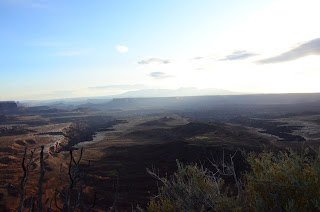
At last, we reached Grand View, which is a perfect place to crawl to the edge and swing your legs over to marvel at the cracks in the earth below. Then, of course, you must do the rim walk to see all the strange columns and formations below from every imaginable angle. It’s hard to believe that water has shaped the earth in so many different ways – in this case, trickles of water freezing and cracking apart long lines of stone. You can see the white rim of sandstone at the edges of the canyons below, Monument Basin where the valley has fallen down, and vertical spires of eroded sandstone in clusters or alone (as in the case of Totem Pole) dotting the basin. There were so many layers of earth that had risen or fallen away.


Our final stop in Canyonlands was at Upheaval Dome. On the hike up, Josh and I guessed at its origins. I favored the salt dome theory that we had learned at Arches, while Josh hypothesized a meteor strike. It turns out these are the two leading theories of the scientific community, as well, although the meteor theory has recently come into greater favor. The hike out to the First Overlook was rather routine, but the hike to the Second Overlook required a good bit more rock scrambling in large wind gusts than either of us had anticipated – and for a rather underwhelming view (everything’s relative, of course).


For the afternoon, we drove back to Arches National Park, since we had secured a pass to the Fiery Furnace.

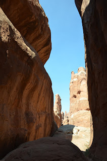
This cluster of rims and columns for a long time had no official path and required a guide, as it was quite easy to become lost. They have since done away with guided tours and created a minimally marked 2-mile loop through the Furnace, though they still warn you to be able to navigate your way out independently. Josh and I were also asked if we were bringing in rope, to which we responded, “Should we?” Apparently much hardier adventurers sometimes rappel down the sheer cliff faces to explore otherwise unreachable crevices. We were fully aware of our beginner status and were fine taking only brief side jaunts off of the counterclockwise path. To obtain our pass, we had to watch a 20-minute video that essentially told us to pack out our waste (including human waste, and the visitor center store conveniently sells bags designed for this purpose) and not disturb the sacred biological crust, home of all microbial activity and birthplace of all Furnace life (all kidding aside, it's very important).
A picture of the biological crust in action.
On arrival to the Furnace, we learned that when they said the path was minimally marked, they took their minimalism seriously. A three-inch white arrow encountered every 20 minutes or so was meant to suffice. This left many a turn unmarked, something that didn’t become a serious problem until about two-thirds of the way through the loop. We encountered two other groups who had paused at a flat area, one to lunch and one out of confusion. The path forward was indicated by one arrow, but after passing it there was no clear way forward. Working with our new supergroup, Josh and I scrambled down each direction, only to meet 50-foot drops that ruled the potential pathways out. I scrambled around a corner of bare rockface, much to Josh’s horror, and he quickly called me back. In the end, it was the father from one of the other groups who discovered the path and the next arrow almost by accident. It did include rounding that corner of bare rockface and then passing into the darkest rock crevice encountered thereafter. Perhaps one more arrow would have helped.


Josh and I hiked onward, relieved we wouldn’t have to retrace our steps to get out of the park alive and now in the company of an older and very adventurous couple. It was fun to have hiking companions, and we passed the remaining time in the Furnace in happy chatter. We also encountered an experienced Furnace hiker who told us of a secret path, a place where you passed the “Dead End Ahead” sign and continued on to a secret arch. We followed his instructions and, just like he said, a new path emerged, tidily bordered with small stones. We saw the shadow of the arch before the arch itself, as it was round yet another corner. But there it was, a hidden gem of the Furnace.


The remaining hike out of the Furnace was the now-standard mix of hiking, hewn steps, and precarious rock scrambling. The path gave itself up without much fuss and the high walls of rock remained absolutely unimpressed by our presence.


A few reflections on Arches and Canyonlands National Parks as this leg of our trip comes to a close:
- Arches: a driving-based park that is extremely impressive with varied hikes. The arches are beautiful; visit all the named ones, but particularly Delicate Arch. Fiery Furnace offers a different kind of adventure, but a welcome one (if you don’t mind scrambling up rocks and a more strenuous adventure). Tickets sell out daily, even in October, so plan to purchase them the day before, preferably in the morning.
- Canyonlands: also a driving-based park. The sunrise at Mesa Arch can’t be beat, and the rim walk by Grand View is wonderful (although with a few tall steps that could be difficult for younger kids). The hike by Upheaval Dome out to the two Viewpoints was a bit underwhelming. Additionally, there was a fair amount of scrambling up smooth rocks in some serious wind gusts, which is not for the fear-of-heights-prone. The longer hike around the other side of the rim sounded daunting, and I can’t imagine the views from there would be worth it given the low-hanging riches to be had elsewhere in the park. Josh and I both felt that a morning at Island in the Sky (the third of the park we visited; each third has to be accessed completely separately and the other two are more ATV-exploration-based) was the perfect taste.


Spotted: Utah highway signs have the highway number inside of a beehive. Apparently, early Mormon settlers felt the beehive represented hard work and industriousness and felt that the cooperation of the bees in constructing something much bigger than themselves was a model for a properly run society.

And my usual extra picture: